To Boldly Go
Captain James Cook and the Search for the Northwest Passage
by Andrew G. Gardner
photos by Dave Doody
Online Extras
Sidebar:
Finding One's Way
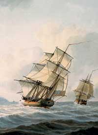
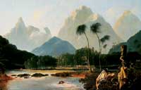
Captain James Cook made his final voyage on a search for the Northwest Passage, a route he thought did not exist. On his travels he made stops at Hawaii and Tahiti, seen in Samuel Adkins’s Resolution and Discovery off the Coast of Tahiti, ca. 1800.
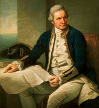
Cook sat for this portrait by Nathaniel Dance in 1775–76, after his second voyage to the Pacific. In 1776, he was summoned to undertake a third, fatal voyage to that ocean.
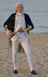
Interpreter Gerald Underdown as Cook, who sailed the Pacific from the Arctic to New Zealand on his last voyage.
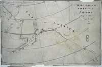
Showing the Bering Strait and parts of the Northwest and Alaska, Cook’s chart traces the Resolution and Discovery’s voyage.
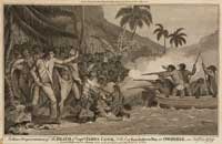
A 1784 engraving by Alexander Hogg of the death of Captain Cook in Hawaii, published in a history of his three Pacific voyages
If in 1776 that great mercantile enterprise known as the British Empire was intent on maintaining its grip on the commerce of thirteen rebellious American colonies, it designed as well to extend the reach of its trade to more distant lands.
Eight days after the Second Continental Congress in Philadelphia adopted its Declaration of Independence, and three thousand miles across the Atlantic Ocean, Captain James Cook, commander of His Majesty’s Ship Resolution, slipped out of Plymouth Harbor on England’s southern coast. With a crew of 112, Cook was embarking on his third and final voyage of discovery to unexplored reaches of the Pacific Ocean. A sister ship, Discovery, with a complement of seventy men, would follow three weeks later, once her commander, Lieutenant Charles Clerke, had been released from a debtor’s prison in London.
What Captain Cook and the crews were to find during the next two and a half years would help to settle an ancient geographic question—whether there existed a trade-route shortcut through Arctic waters from the Old World to Asia. The English had been looking for a Northwest Passage since John Cabot sailed in 1497. In the intervening 279 years, scores of European adventurers had taken up the quest, and some were still convinced discovery of the Northwest Passage was a matter of time.
Americans were this year occupied, as they would be for five years more, with their struggle to escape British rule. Reconnoitering what lay thousands of unmapped miles to the west would have to wait for men like Lewis and Clark, dispatched in 1803 by President Thomas Jefferson to find an all-water inland route to the Pacific. Like Cook, they would fail of their object, but like Lewis and Clark, the captain would fill in some of the gaps in the global atlas, and harbor the expansion of the United States.
Cook’s final voyage of discovery, funded by the British admiralty, would explore and put on the map two jewels that, in the fullness of time, would become integral parts of the United States—Hawaii and Alaska.
It is difficult to fathom the courage and dedication required of Cook, or any of the great adventurers through the ages, on their voyages of discovery. Though the round-the-world passages of Ferdinand Magellan and Sir Francis Drake had shown the planet could be circumnavigated safely, sailing into the unknown must have been daunting. In the context of today, the intimidating challenges of manned spaceflight may come near the mark.
Captain Kirk of television’s Star Trek is remembered “to boldly go . . . ,” albeit fictionally. More than two centuries ago, Captain Cook summed up his real-life intentions. They were to go not only “farther than any man has been before me, but as far as I think it is possible for man to go.” He succeeded.
Cook learned the art of surveying and chart making on the St. Lawrence River and the coasts of Halifax during the French and Indian War. For five subsequent summers, he surveyed the Newfoundland coast. His Pacific voyages, however, were more than mapping expeditions. His ships took astronomers, artists, natural historians, and scientists to document what they found in new, far-flung lands. On his first voyage, in 1768, he took HMS Endeavour to Tahiti to observe the passage of Venus across the face of the sun, observations that would help scientists determine the distance between the sun and the earth. His orders also directed him to search the southern ocean for a continent presumed to be near the pole. In that effort, Cook was disappointed, but he explored New Zealand, as well as the coasts of Australia, fixing their locations.
A second voyage in 1772 took Cook, Resolution, and HMS Adventure to look again for the southern continent. Rounding the Cape of Good Hope, they became the first European vessels to cross the Antarctic Circle. Ice barred the way to Antarctica, and Cook turned north to discover more Pacific islands. A final probe for Antarctica failed, but the explorers sailed farther south than any men before them.
Benjamin Franklin so respected Cook and his endeavors that he asked that despite the war with Britain, American ships on no account attack Cook’s expedition. Franklin said Cook’s undertaking was truly laudable in itself as the increase of Geographical Knowledge facilitates the communication between distant nations in the exchange of useful products and manufactures, and the extension of the arts whereby the common enjoyments of Human Life are multiplied and augmented and science of other kinds to the benefits of Mankind in general.
The Honorable John Forbes, Royal Navy, Admiral of the Fleet, wrote in the official account of Cook’s third voyage that its object “was to discover and ascertain the boundaries of Asia and America and to penetrate into the Northern area by the North East Cape of Asia.” But this was by no means the whole story.
One third of the world’s surface remained unexplored, and no one knew what fine colonial prizes still might be there for the picking. So, at the advanced age of forty-eight, Captain Cook was called out of a comfortable retirement to lead one more expedition.
Before Cook’s South Seas voyages, the Spanish dominated Pacific exploration. Following Columbus’s first transatlantic voyage—he, too, was looking for a shorter route to Asia—the Spanish relied on a 1493 papal declaration, and the Treaty of Tordesillas of the following year, for the exclusive right to colonize all the New World. Except Brazil. Brazil went to Portugal.
So, when Vasco Balboa, a Spaniard, crossed the Panamanian isthmus in 1513 and gazed across the Pacific for the first time, the loyal subject claimed it for his monarch, King Ferdinand. And for good measure, in an audacious geographic heist, he put a Spanish “no trespassing” sign on all the lands touching that sea.
The Protestant English, of course, never accepted the Catholic carve-up of this prime international real estate, and the fuse was lit for three hundred years of fireworks. But by the time Captain Cook arrived on the Pacific scene in the late 1760s, the Spanish had improved their claim only by settling Catholic missions along the coastline of what today constitutes the Baja Peninsula, Southern California, and the Philippines. The north Pacific and its territories remained largely unexplored.
After Vitus Bering’s 1741 expedition discovered and claimed Alaska for the Russian czar, Russian fur hunters had begun to spread down the west coast of the continent, encroaching on the Spanish preserve. Alarm bells started to ring in the court of Madrid.
Cook’s orders for his third voyage were hush-hush, reflecting the cat-and-mouse games of international politics. The captain’s secret orders could only be unsealed once Resolution had reached Tahiti. “By His Majesty’s pleasure,” Cook’s main task was to continue with the quest to find the Northwest Passage.
Since 1745, the British government had offered a £20,000 prize—worth about $4 million today—to the first ship to discover such a route, north of 52 degrees—about 100 miles below the southern tip of the Alaska panhandle. With knowledge gained from Hudson’s Bay Company explorers who had reached the Arctic Ocean overland, the British Admiralty reasoned that the passage had to be further north—near 61 degrees.
For the nation discovering the Northwest Passage, the payoff would be immense. Sir Francis Drake had secretly tried and failed to discover a way. The Spanish, too, were secretive, but remained convinced that the Strait of Anian, as they called the route, began at latitude 42 degrees north near the present California and Oregon border. Admiral Bartholomew de Fonte of Spain said he had found a way through in 1640, but Cook called it a fabrication and said, “For my own part I give no credit to such vague and improbable stories, that carry their own confutation along with them.” Cook’s voyage would settle the argument.
The captain’s route took him to the Cape of Good Hope, where he met Discovery, then on to Tahiti by way of New Zealand. The secret orders were opened, and they set their course for New Albion, as Drake had christened the North American west coast.
En route, on January 18, 1778, the crew of the Resolution became the first Europeans to sight and set foot on islands in the Hawaiian chain. Cook named them the Sandwich Islands after his sponsor, Lord Sandwich. He noted that their position, halfway between the Americas and Asia, made them a prize for any country that could claim and control them.
On February 2, after a fortnight of rest and relaxation amid the swaying Polynesian palms, Cook’s expedition weighed anchors and set a northeasterly course. A “gentle gale” helped it on its way. A month later, during a storm, it sighted the North American coast. Cook promptly called the Oregon promontory he saw through his spyglass Cape Foul Weather—its name today.
Cook steered to larboard, heading north. Resolution and Discovery fought the heavy weather to stay on course, and keep a safe distance from the coastline in his lee. Desperate to replenish water supplies and looking for a haven to make repairs, Cook anchored his ships at Nootka Sound, halfway up the Pacific coast of Vancouver Island in British Columbia.
There Cook found the natives keen to trade, particularly for metal. The Iron Age and the Industrial Revolution had not reached these lands, but a fleeting contact with a Spanish ship four years earlier had whetted the natives’ appetite for all things metallic. Knives, nails, barrel hoops, belt buckles, and brass buttons were stripped and exchanged for luxurious sea-otter pelts. Some ship’s fittings disappeared, but Cook’s ships took on board 1,500 furs.
With Resolution recaulked and fitted with a new mizzenmast, Cook ventured out once again into the North Pacific. For the summer of 1778 Resolution and Discovery ploughed through pounding seas surveying the storm-tossed Alaska coastline, still trading for furs and still searching for a way through to the Arctic Ocean. There was none.
Twenty years before, a Russian survey had put down Alaska for an island. Perhaps it mistook the 200-mile inlet that borders the present site of Anchorage for a short-cut north. Cook’s name was given to the sea channel—Cook Inlet—that had misled the Russian mapmakers.
His ships tracked 1,000 miles southwest down the Alaska Peninsula before heading into the Bering Sea. In early August, they made landfall at today’s Cape Newenham, where, in keeping with his secret orders, he dispatched an officer ashore to climb a hill, knock in a stake, and claim all of Alaska for His Britannic Majesty King George III, joining Spain and Russia in claiming the territory. Cook realized, however, that even with the lure of the fur trade, it would be hard for Britain to capitalize on its claim. “Unless the northern passage is found it seems rather too remote for Great Britain to receive any emolument from it,” he wrote. He was right. “Alashka,” as the Russians called it, was 15,000 sea miles from England by way of Cape Horn.
By mid-August, Resolution and Discovery had traversed the Bering Sea to Siberia, and headed north again, crossing the Arctic Circle and reaching latitude 70 degrees north—as far north as Cook had been south of the equator on his previous voyage. But the short Arctic summer was over and so was Cook’s search. The weather was turning dangerously cold, and a wall of pack ice stood twelve-foot high ahead of them. The ships began to retrace their steps and head south to Hawaii for the winter. The plan was to resume the search the following spring. But it was the last time Captain James Cook would ever set eyes on North America.
There is controversy about Captain Cook’s death in Hawaii. By all accounts, his health had deteriorated over the course of the two-and-a-half-year voyage. He was exhausted and his judgment was impaired. On the morning of February 14, 1779, the usually levelheaded captain got into an argument with natives on the shore of Kealakekua Bay on the Island of Owhyee, the largest and easternmost island in the Hawaiian chain. The dispute was over a ship’s cutter—a small boat—that a native had stolen. Harsh words led to fighting. Cook had ten marines with him, but a throng of angry Hawaiians outnumbered the English. The captain shot one man dead, and in the melee Cook and four marines were killed. It was the end of the man who has been hailed as “the ablest and most renowned Navigator . . . any country hath produced.”
What was the legacy of Captain Cook’s last voyage?
- Thanks to his surveys and navigation, important gaps in North American maps could for the first time be sketched in.
- After Cook’s death, his crew visited Petropavlosk on Russia’s Kamchatka peninsula and Macau in China, where their sea-otter pelts fetched a half-million dollars at today’s prices. With wealth for the taking on this scale, a Pacific fur trade was inevitable. During the next hundred years along the 6,000 miles of the north Pacific coastline from Alaska to Oregon, the British, Russians, and Americans—who had assumed Spain’s claims under a treaty signed in 1819—vied with each other for dominance. The sea otter was hunted almost to extinction.
- Following in Cook’s wake, the search for the Northwest Passage headed into the high Arctic. In 1906, the Norwegian adventurer Roald Amundsen showed that an icy passage did exist. But another seventy-three years passed before the United States oil tanker Manhattan punched its way through the ice from the North Atlantic to the Pacific.
- It was left up to Captain Cook’s Lieutenant William Bligh—of later Mutiny on the Bounty notoriety—to map the Hawaiian chain in detail. Fifteen years later, on February 25, 1794, one of Cook’s up and coming officers—Midshipman George Vancouver—raised the Union Jack and claimed Hawaii for the British Crown, a move that set the wheels in motion for the islands’ annexation by the United States in 1900 and statehood in 1959.
- In 1867, the young United States bought Alaska from a cash-strapped Russia for $7.2 million, or 2 cents an acre. Many Americans scoffed at the purchase and called it Seward’s Folly, after Secretary of State William Seward, who negotiated the deal. By the purchase, the United States doubled the length of its coastline.
Andrew Gardner, who writes on Canada’s Salt Spring Island, contributed to the autumn 2005 journal an article about eighteenth-century veterinary science.

