Niger River

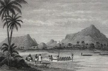
The Niger River is the third longest river in Africa and one of the fifteen longest in the world, reaching about 4,200km from the interior to the Atlantic. Its long flow and unusual course have helped to make it important to commerce and culture throughout much of West Africa.
The Niger River begins in the Futa Jalon highlands of Guinea where it takes a northerly route into Mali. As the river reaches farther north into the Sahara Desert, it joins with tributaries and fans out into a large network of lakes, streams, and marshes. This part of the river, called the Niger Inland Delta, forms a large oasis in an otherwise arid zone.
The ancient kingdoms of Gao and Mali emerged in the area, using the inland delta as a source of water, food, and commerce. The trading port of Timbuktu stands at the northeastern end of the delta. From there, the river flows east and then southeast before entering the country of Niger. Passing along the border of Benin, the river enters Nigeria where it turns south toward the Atlantic. The Niger delta, where the river meets the Atlantic ocean, forms an important ecological and commercial zone. The delta is currently a major site for petroleum production in Nigeria.
History & Memory
Related Pages:
-
 Carnelian bead
-
 Ancona Robin John and Little Ephraim Robin John
-
 West Africa
-
 Bight of Biafra
-
 Slave ship model

